Southern Circuit
Turkana Land – Southern Circuit
One of the must-visits of Turkana Land’s Southern Circuit are the hot waterfalls of Kapedot – not only for those who seek healing from their skin ailments.
Overview
Distance: Approximately 590 kilometres
- Day 1: Home – Marigat – Lake Baringo – Kapedo (Marigat-Kapedo: 88km, tarmac and gravel)
- Day 2: Kapedo – Kerio River – Lokori (101km, gravel and dust)
- Day 3: Lokori – Katilu – South Turkana National Reserve (214km, gravel)
- Day 4: South Turkana National Reserve – Kerio Valley, Cherangani Hills or Kitale (South Turkana-Kitale: 184km, 80km bad gravel, rest tarmac)
- Day 5: Driving home
Petrol & Supplies: Marigat, Lokichar and Marich Pass
Accommodation: Baringo good, Kapedo basic, Lokori camping, Katilu basic, South Turkana National Reserve camping, Kerio Valley basic, Cherangani Hills basic or camping, Kitale good
The main road of Kainuk. The small town guards the border with West Pokot County along the main road between South Turkana National Reserve and Marich Pass.
Day 1
Through the Rift Valley to Turkana Land
The drive up the Rift Valley past Nakuru, Lake Bogoria and Lake Baringo offers plenty of attractions and the chance to approach Turkana Land in a slow way.
Practical info
In a long driving day, you can drive up from Nairobi and arrive in Kapedo before dark. Make sure you restock petrol and other supplies at Marigat and start for Kapedo latest 2pm. Rather stay at Lake Baringo overnight and start early in the morning if you are running late.
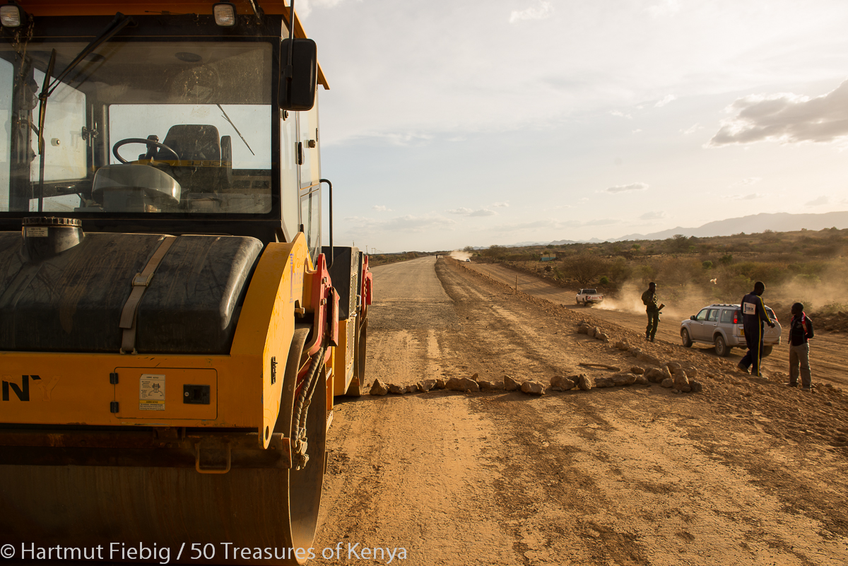
Road construction between Lake Baringo and Nginyang. Once the new tarmac road is finished it will significantly shorten the drive to Kapedo, the town where you enter Turkana Land.
Day 2
Kapedo
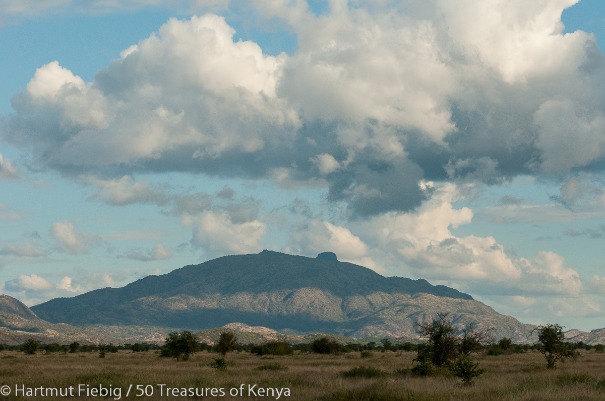
Kapedo lies at the southern boundary of Turkana Land which is shared with Baringo County. Its setting is scenic, framed by Silali volcano in the east and the foothills of Tiati Mountain to the west.
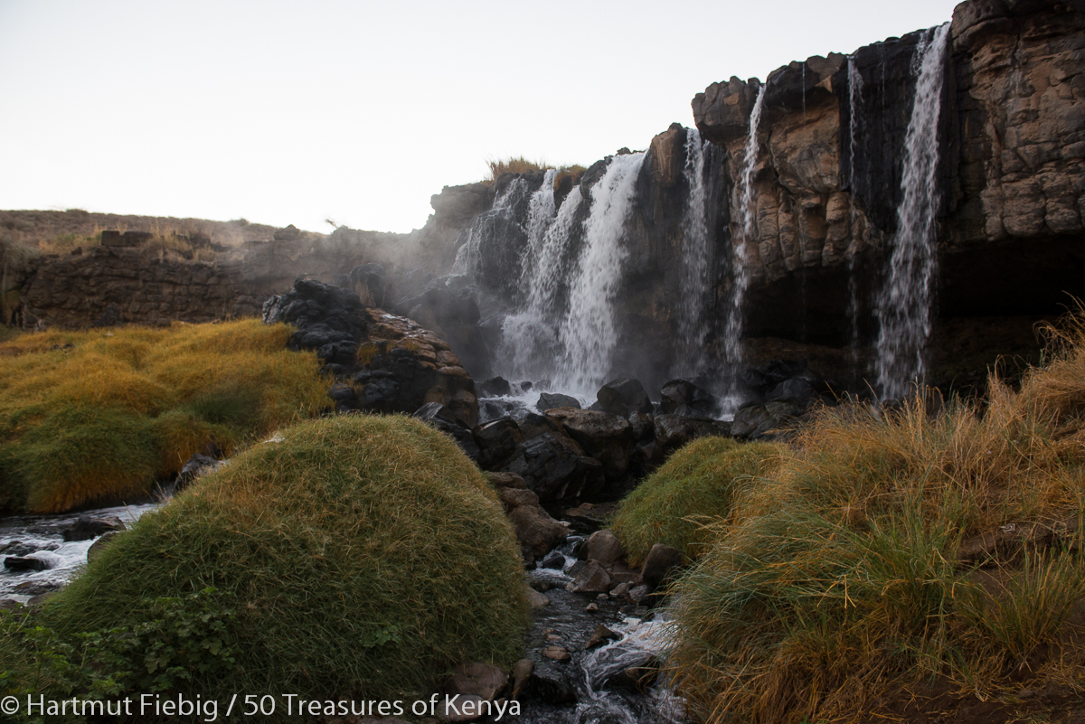
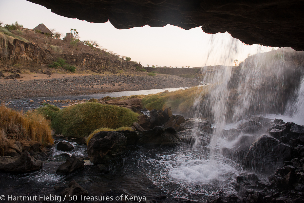
The bigger of the two hot waterfalls of Kapedo at dawn.
Kapedo’s major attraction are two hot waterfalls which merge with Suguta river, creating a huge natural spa with mineral water which is said to cure many skin ailments. A bath in the warm water at night or early in the morning is an absolute delight and an unforgettable treat.
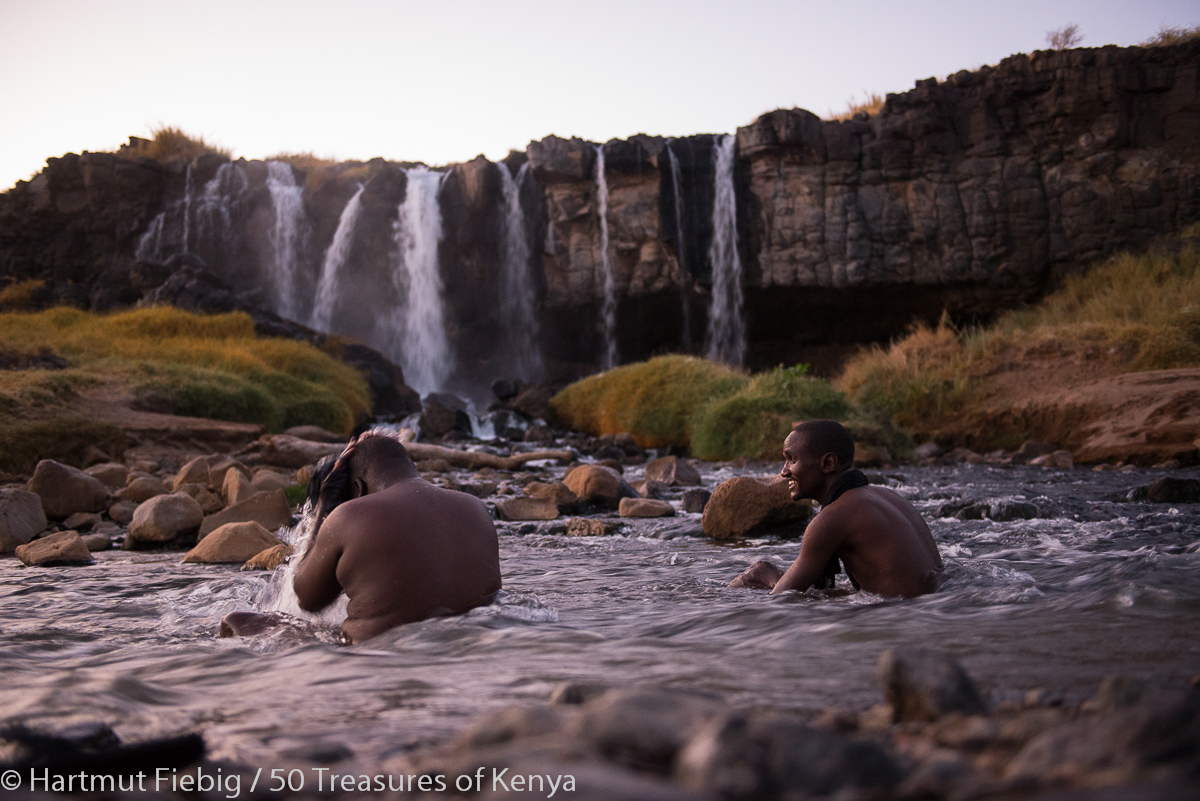
Bathing in the hot water of Silali River is a cure for skin and soul, especially when you come in the early morning and the river resembles a steaming bathing tub. But first, find out about women’s and men’s time slots for bathing!
The banks of Suguta river are overgrown by an amazing dryland vegetation most beautiful of which is the desert rose.
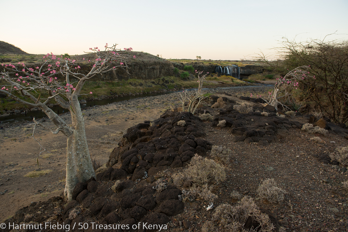
Desert roses grow at the rocky banks of Suguta river near the hot waterfalls of Kapedo.
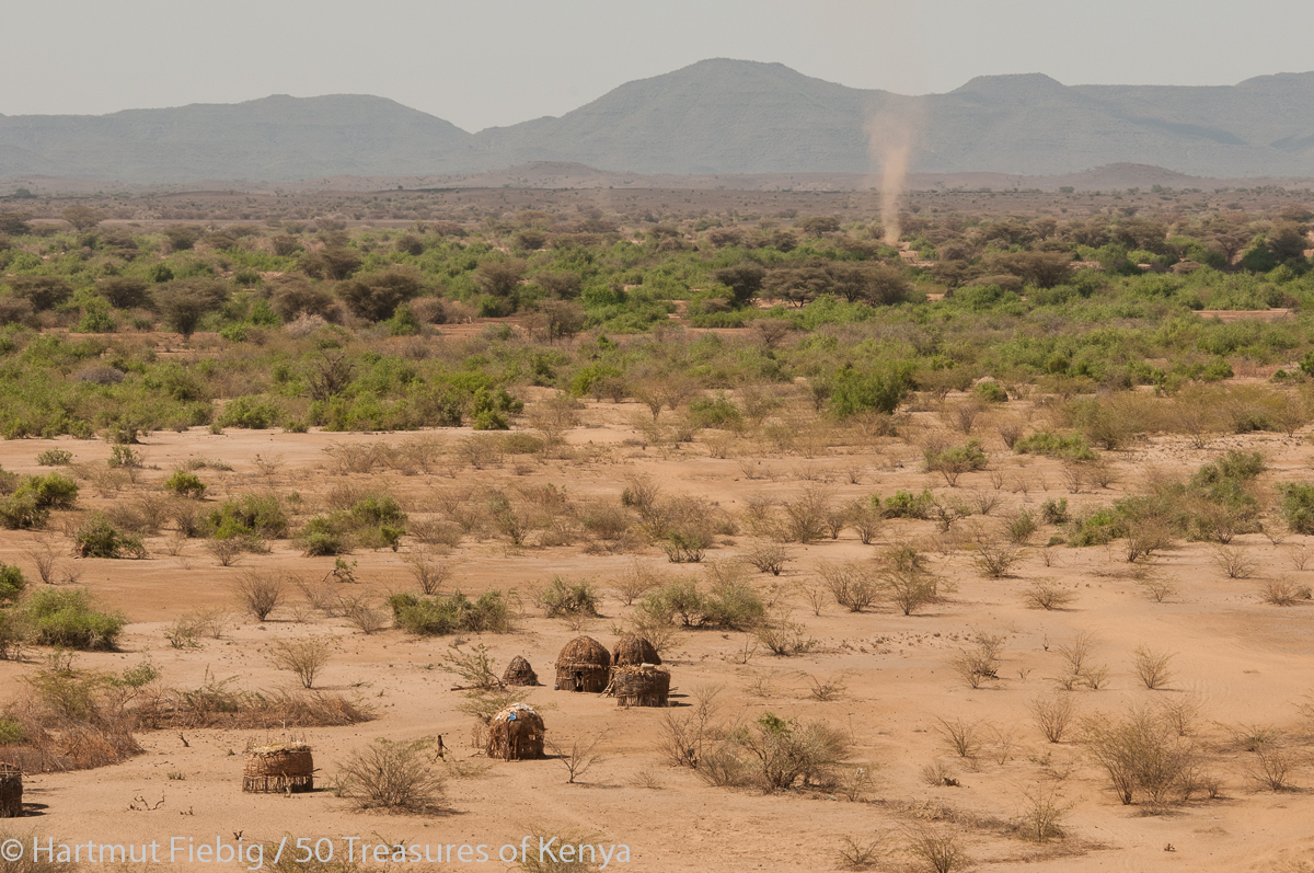
Kapedo’s traditional part is dominated by handsome Turkana huts. Pokot people also graze in the area, a fact that has resulted in eventual skirmishes during the past. Some dukas, schools and a mission station form the public part of the small town.
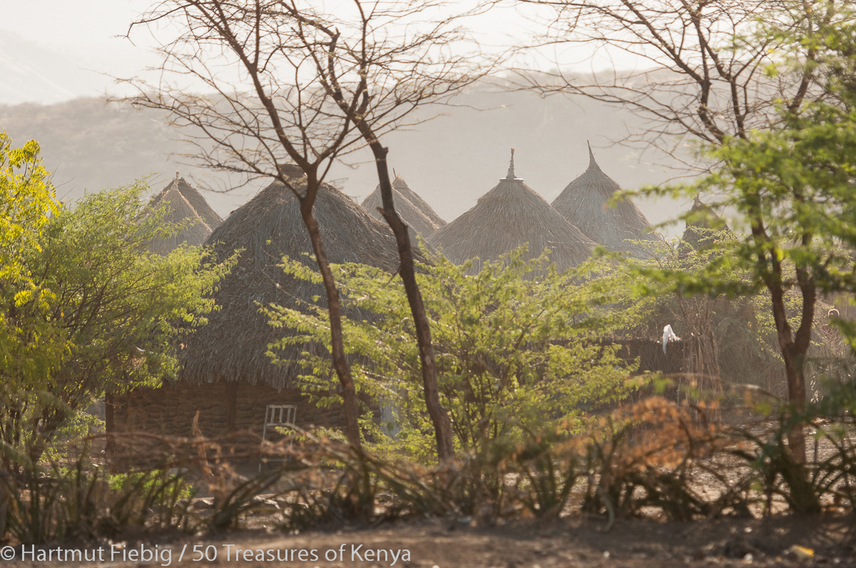
Typical cone shaped Turkana houses in Kapedo.
Practical info
Accommodation: The mission station in the center offers some basic accommodation. Contacts: Full Gospel Church Kapedo Guest House, Rev. David Elim, 0728-629 758. Its advisable to book rooms in advance and preorder food. Network reception in Kapedo is weak, so better send a text.
Activities: At the mission station you also might be helped finding a friendly local guide who is happy to show you around town or take you to the surrounding hills or up Silali volcano, which takes a long and hot hiking day.
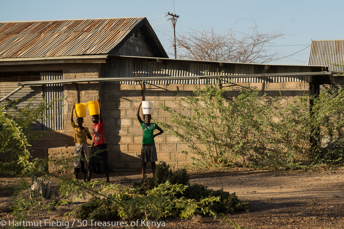
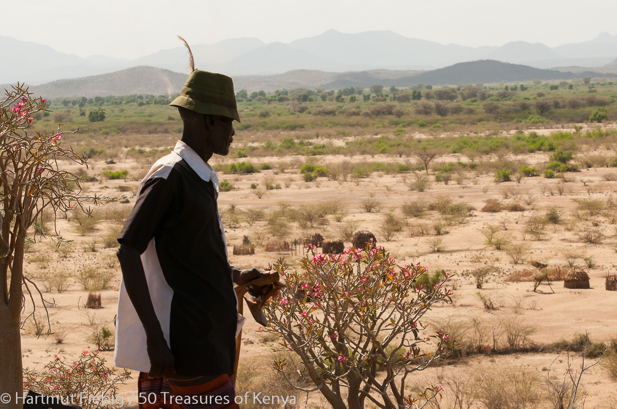
Girls fetching water from the river pass the mission school of Kapedo.
Napetakinyanga – where the crocodiles come out of the water
Further downstream, some 10km out of town, Suguta river forms a pleasant landscape with sandy beaches that attract basking crocodiles. Hence the local name of the place: Napetakinyanga or ‘where the crocodiles come out of the water’.
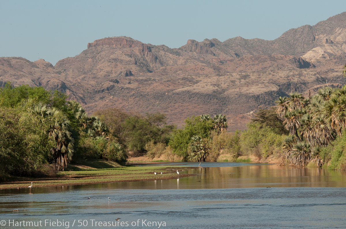
At Napetakinyanga, Suguta river is forming pools where the waters run still, framed by nice sandy beaches with palm and tooth brush trees, myriads of birds and basking crocodiles.
Barren Land
For the stretch between Kapedo and Lokori you might have to take a guard onboard as what follows behind Kapedo is a partly dusty, partly bumpy drive leading you through lonesome, rough terrain.
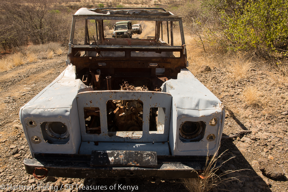
A given-up Landie on the barren stretch between Kapedo and Lokori. You might wait a long time for any support if you have a break down or any emergency. So make sure you drive with at least two cars.
The heat-strucken semi desert is a harsh beauty, a no-man land with only few oases that attract shy gazelles.
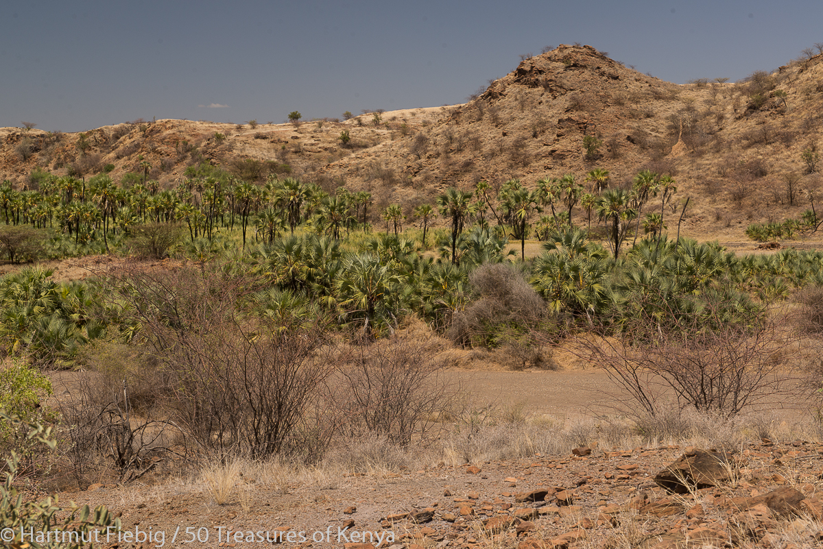
Water points for the shy wildlife is few and restricted to a few oasis marked by dense palm grooves in the dry hills north of Mt. Tiati.
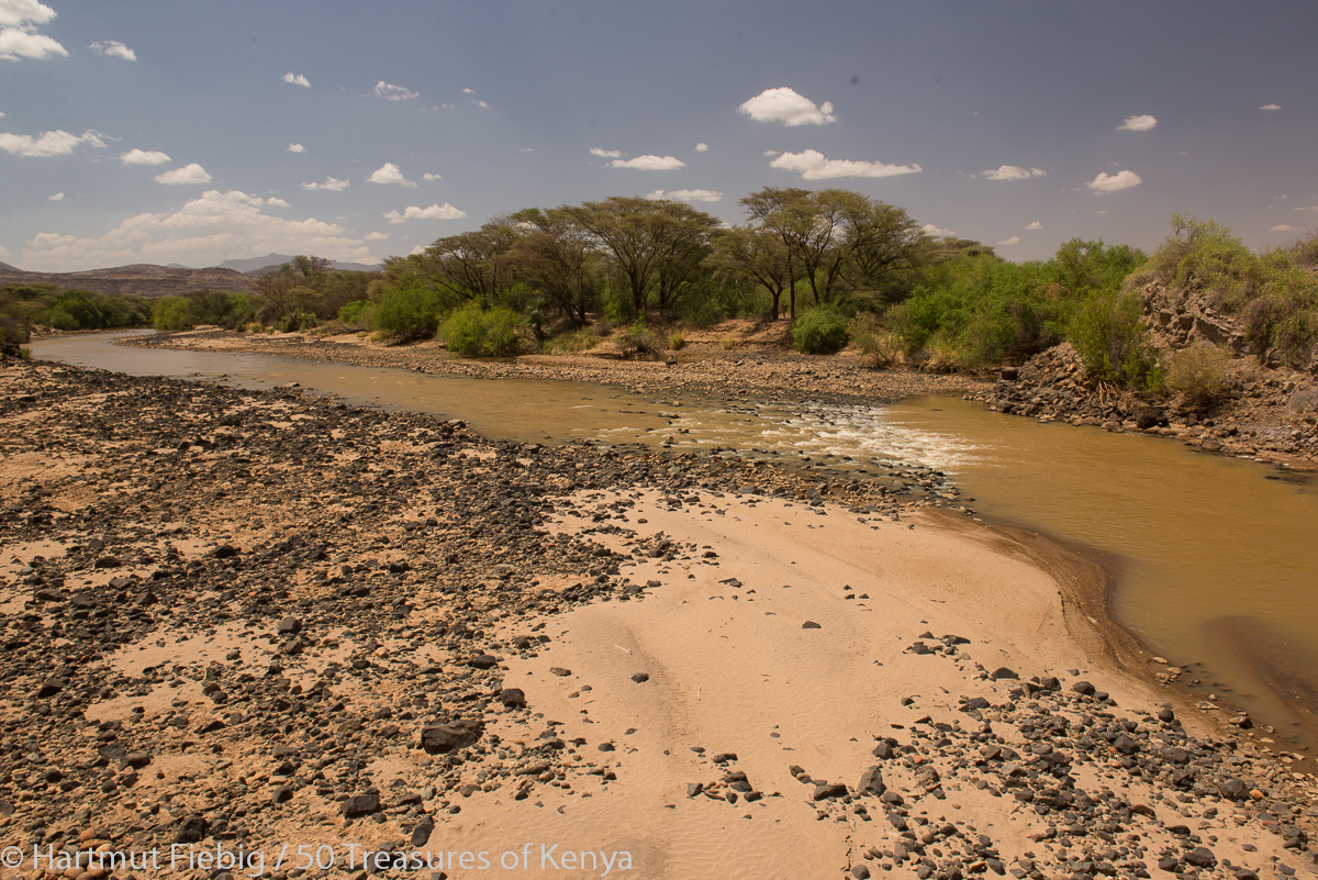
Kerio River
After all the dryness in the plains and hills behind, reaching the brown waters of Kerio River offers true comfort. On the other side of the steel bridge the land opens into the northern plains – a country of completely different features but equally dry. Kerio river is the second biggest permanent stream that winds through the County to feed Lake Turkana.
The river banks of Kerio River are seamed by green trees – a true comfort for the eyes in an otherwise dry land.
Lokori Standing Stones
Not far after crossing the river, you reach Lokori, an oasis of green trees that stretches for kilometers along Kerio river and some seasonal rivers or lagas of the region.
Dust devils run over the sandy plains around the Lokori Standing Stones.
The standing stones of Lokori are found at the edge of Lokwii village, a few kilometres drive from the main road. Dozens of natural rock slabs are meticulously arranged in circles, some still standing, others fallen, which resemble miniature homesteads on a closer look.
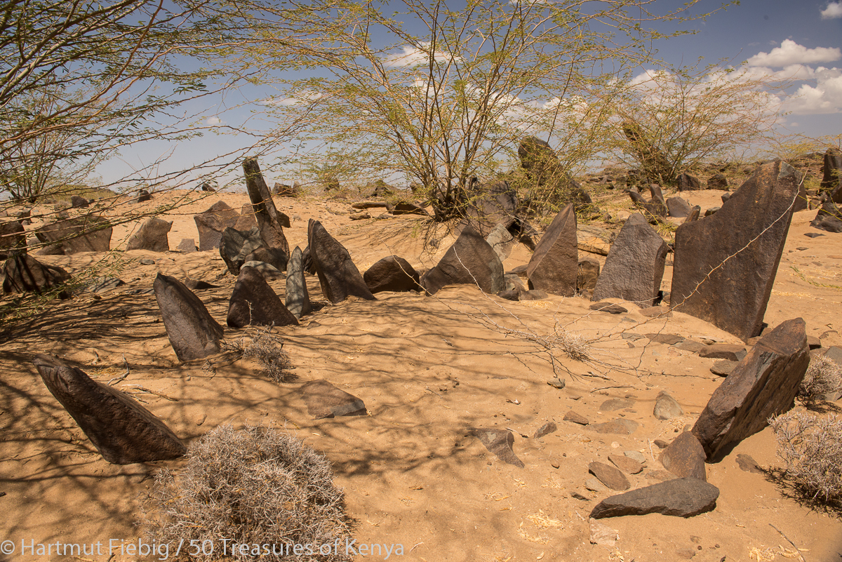
The Lokori Standing Stones are one of the most impressive prehistoric rememnants in Turkana Land. Several circles of standing stones mark a sacred location of Turkana Land’s ancestors.
On the nearby rocky hill there are numerous engravings displaying mysterious signs. For the people then who erected the stone circles, this place surrounded by water, wildlife and grazing must have been a very sacred place. From here, you enjoy a brilliant view over the plains and huge dust devils.
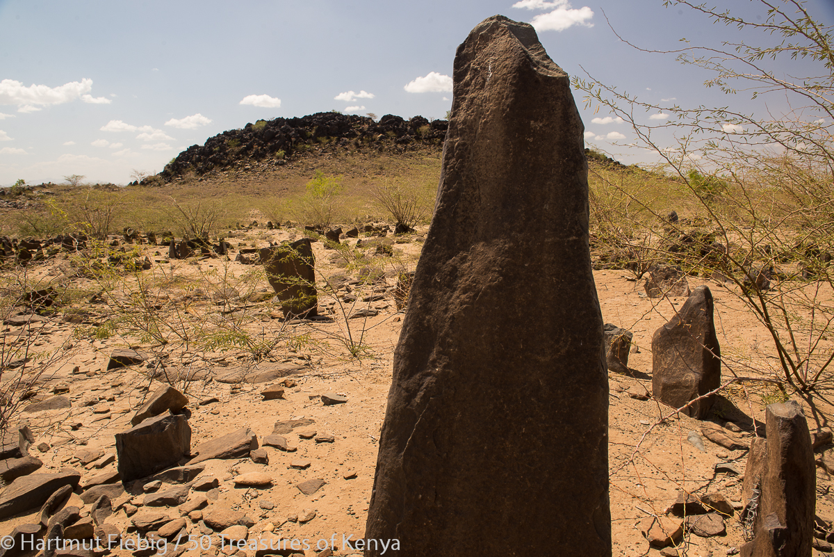
Not far from the stone circles there is a rocky hill with mysterious rock engravings.
According to a myth told by one of the local Turkana elders, the stones indeed are people. Once upon a time in a Turkana village there was a big festival with traditional dances until late in the night. The villagers were informed a man dressed in strange regalia would join. They were warned never to laugh at him or else something bad would happen. But when the strangely dressed man started to dance, his style was so funny that the whole village burst out laughing. Within seconds everything was quite. Everybody had turned to stone. Hence, locally the name Namorutunga of Lokori is used – Namorutunga meaning ‘Stone People’ in Turkana.
Note: Please respect this age old holy place, don’t touch the stone circles or the engravings and take your garbage along.
An elder from the huts close by tells the myth of Namorutunga – the Stone People.
Practical Info
Accommodation: With permission of the locals, you may camp in vicinity of the site.
Food: In Lokori town at the main road you will find a simple restaurant with warm sodas.
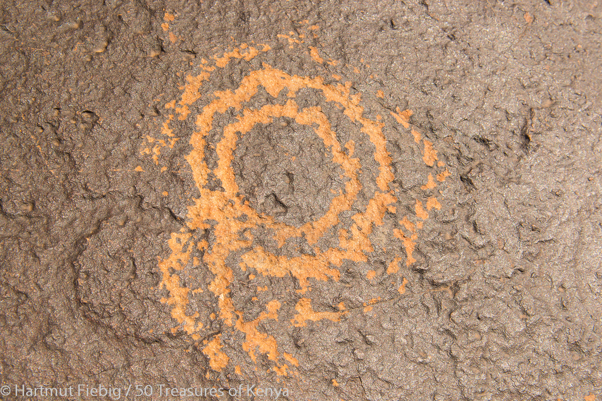
Meaning and creators of the mysterious rock engravings at the hill in Lokwii remain unknown up to this day.
Day 3
The Oil Belt of South Turkana
Behind Lokori, the gravel road improves dramatically. ‘Who needs all those well maintained roads branching off into nowhere?’, you might wonder. Don’t overspeed and watch out for heavy trucks and machinery instead. You are crossing the oil belt of Turkana Land.
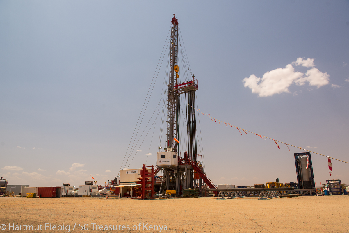
Exploration rigs have been erected for test drilling where seismic research has indicated high probability of oil deposits.
The roads feed oil exploration teams and the drilling platforms. The rigs are well secured and can not be visited by tourists at the moment.
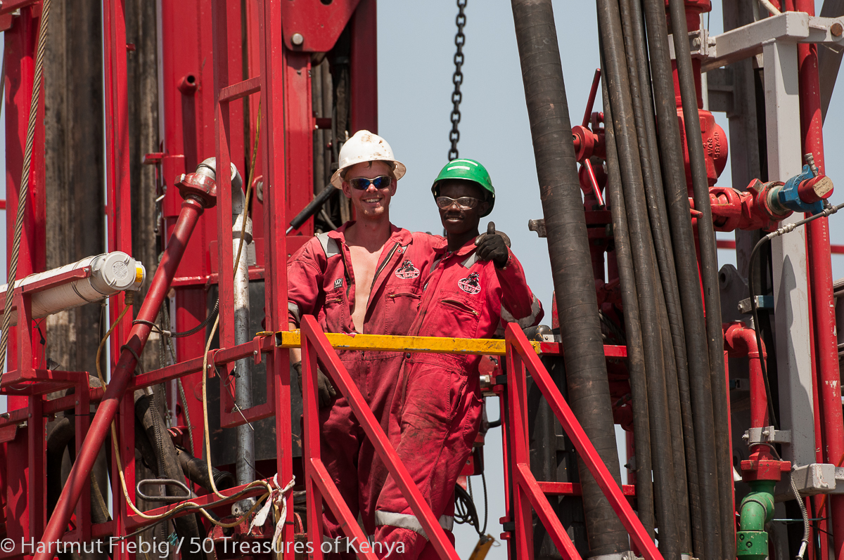
Oil workers on a drilling platform in Turkana Land.
Lokichar
Lokichar on the main road to Lodwar is a boom town that profits from the oil industry in the region. It marks the northernmost point of the Southern Circuit. Yet, you have merely clocked a third of Turkana Land’s full north-south distance! If you want to connect to the Northwestern Circuit or the Central Circuit, it is another 80km rough road to Lodwar.
Practical Info
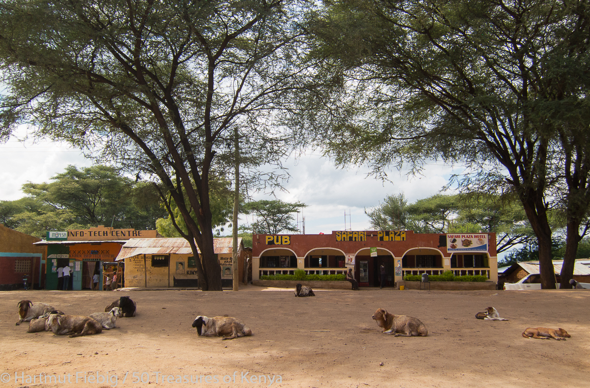
Lokichar doesn’t offer any attractions but you get decent accommodation, food and petrol here.
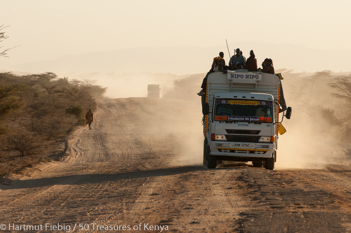
Trucks with additional passengers serve the main road from Lokichar to Lodwar in their rear long trails of dust.
Katilu
Driving from Lokichar to Katilu at the banks of Turkwell River in southwesterly direction, the Lokichar Hills with their impressive rocks stretch on the left of the road, offering tempting opportunities for hiking and a wonderful view from the top.
Lokichar hills offer tempting views and hiking terrain close to the Marich Pass-Lodwar road.
Reaching Katilu you are surprised by lush green farms, irrigated with water from Turkwell River, the biggest stream of Turkana Land.
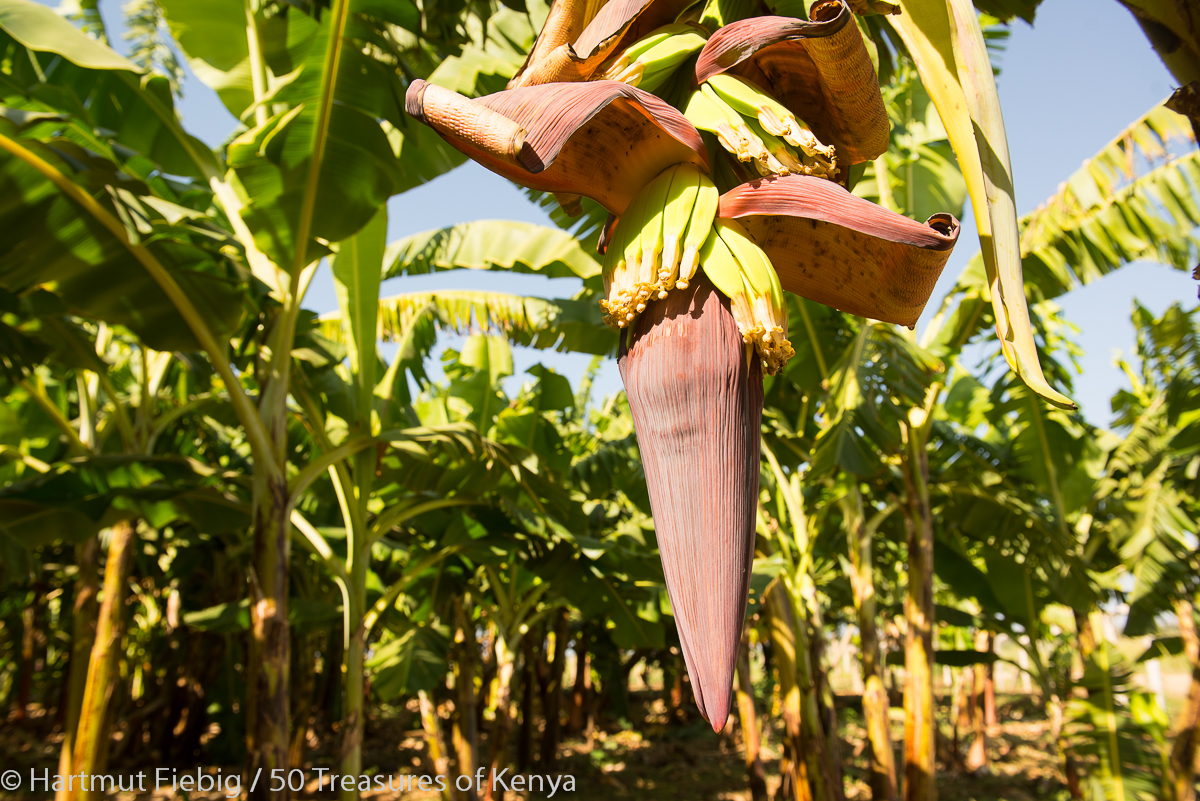
Beside cereals and vegetables, the Katilu irrigation scheme produces fruits and cooking bananas.
The huge irrigation scheme makes the promise of a future without food shortage that has held the County between its teeth whenever serious drought bite in the past.
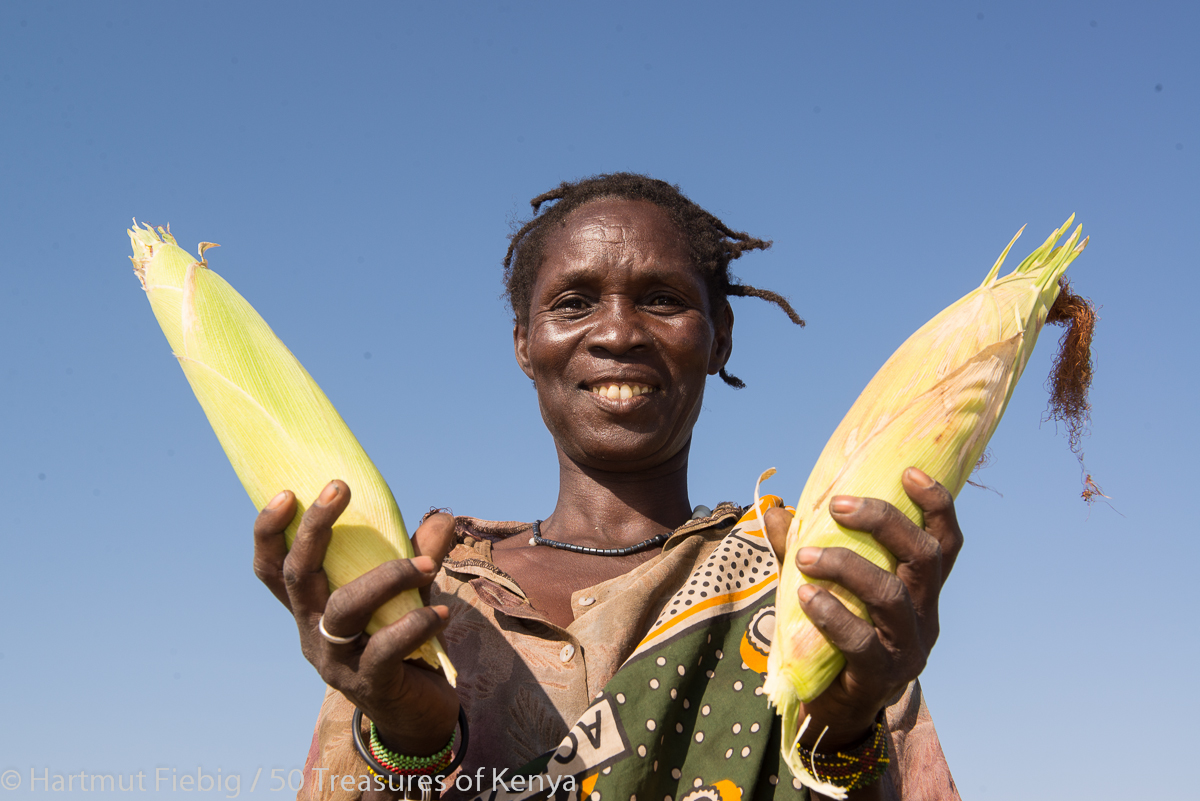
Being former pastoralists, some of the local Turkana families of Katilu have successfully switched to farming.
Katilu offers cool shady spots for a picnic at the banks of the river near the water intake for the irrigation scheme and gives you an opportunity to stock fresh farm produce. Crops planted include maize, sorghum, beans, cow peas, cooking banana, green grams and rice.
Practical info
Accommodation: Katilu Catholic Parish Guest House offers simple accommodation, pre-booking of rooms and food is advisable. Call Maggy, 0701-097337 or Brother Innocent, 0725-717266.
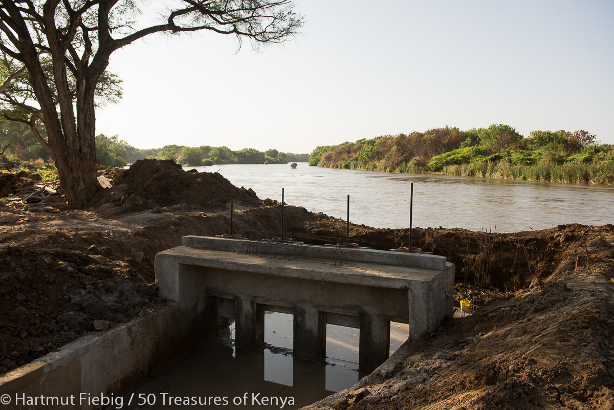
At the water intake of Katilu irrigation scheme – a wonderful spot for a picnic on the banks of River Turkwell, Turkana Land’s biggest river.
South Turkana National Reserve
On the last stage of the Southern Circuit you drive from the man made eden of Katilu southwards into the natural paradise of South Turkana National Reserve which stretches east of the road. With almost 1100kmsq it is a vast expanse of wilderness and home to elephant, gazelle, warthog, buffalo, giraffe, zebra, leopard and hyena.
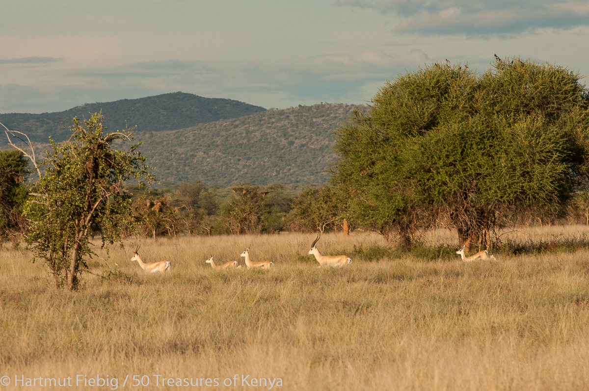
A herd of Grant’s gazelles dashes over the grassland plains of South Turkana National Reserve.
The park’s inofficial mascot however is the Kori bustard. The tall bird hunting in the grass savanna occurs in higher numbers than anywhere else in Kenya.
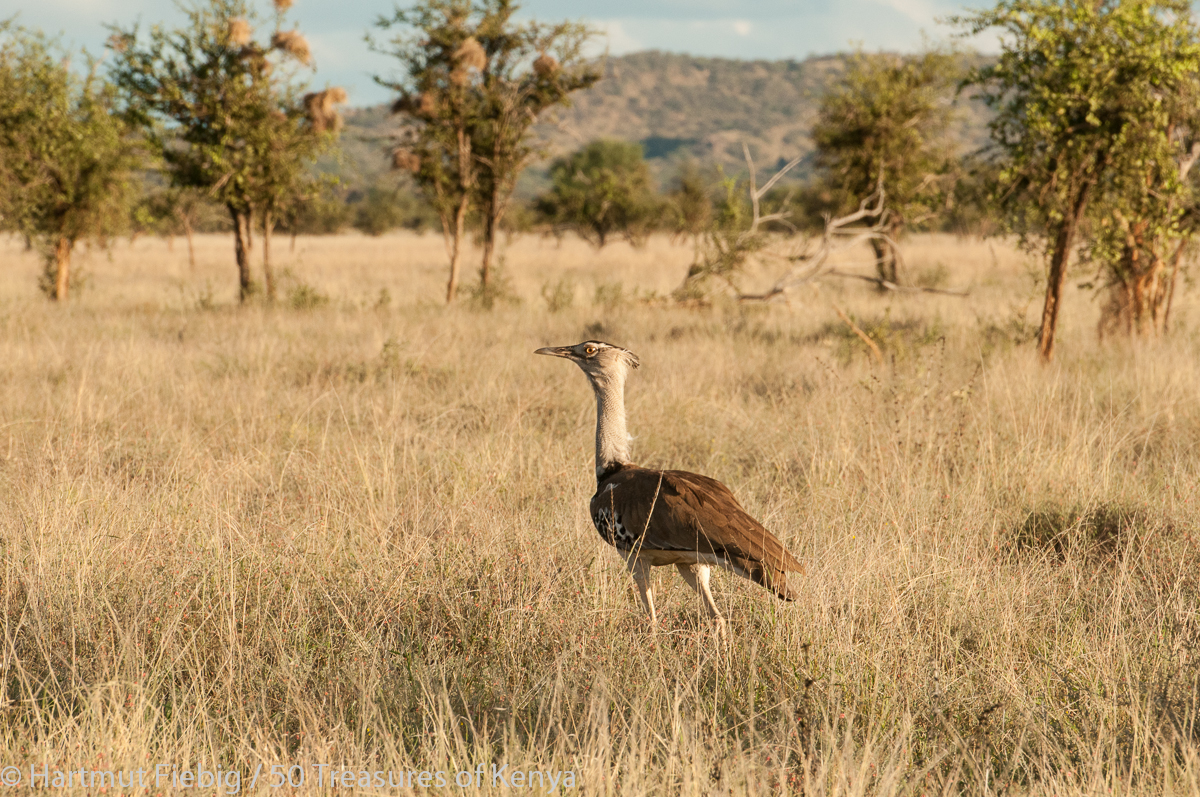
The number of Kori bustards at South Turkana National Reserve is merely outstanding.
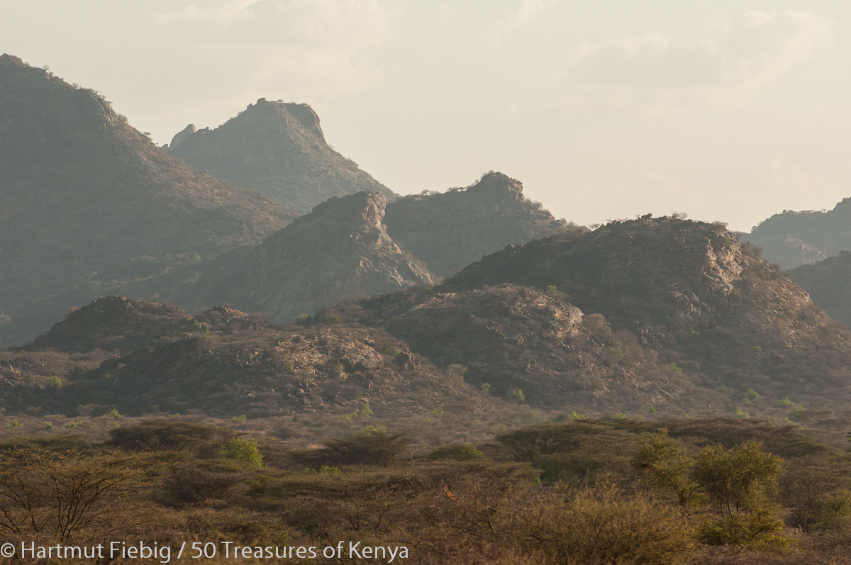
South Turkana’s landscape is stunning as you enjoy great views of Mount Mtelo and Mount Nasolot in the west.
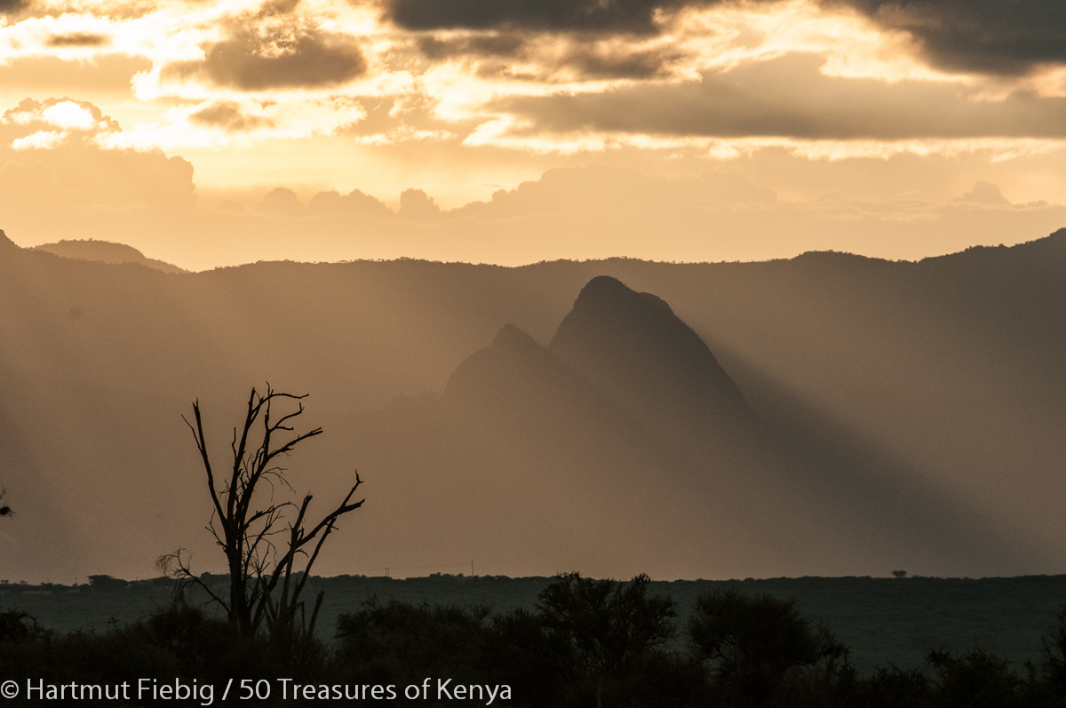
Mount Nasolot is peeled from the haze by the shades cast in late afternoon.
Even more impressive are the vast grasslands stretching up to the northern horizons, only interrupted by giant ant hills.
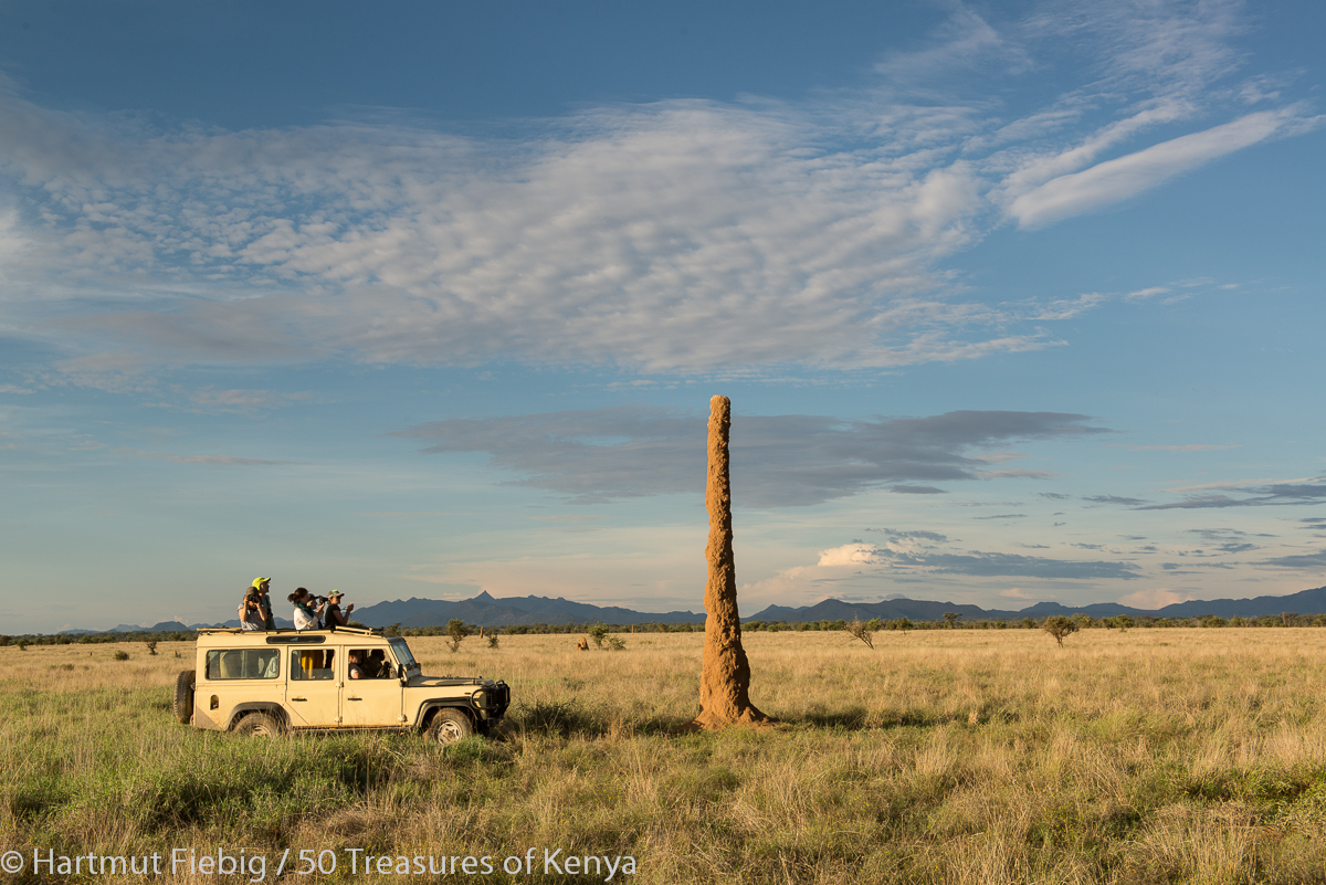
The ant hills of South Turkana are true giants and contribute their share to the very special charm of South Turkana National Reserve.
In the centre of the national reserve rests Kailongol mountain which peaks at 2067m and can be climbed on food. Expect to camp on the mountain as there are no regular tracks yet and it is serious bush walking.
Kailongol Mountain in the midst of the reserve doesn’t look specifically high but towers at 2067m. If you want to reach the top, you should reckon with one and a half days of walking.
On the eastern side of the mountain there are salty springs that attract Pokot herdsmen and game alike.
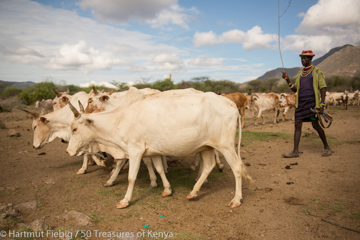
Pokot herdsman and his cattle at the hot springs on the eastern side of Kailongol Mountain.
Practical Info
Accommodation: There is a camping site at the park headquarters near the main road.
Activities: Game drives, walking safaris, mountain walking and bird watching are the major activities in the park. You can obtain rangers at the headquarters to accompany and guide you.
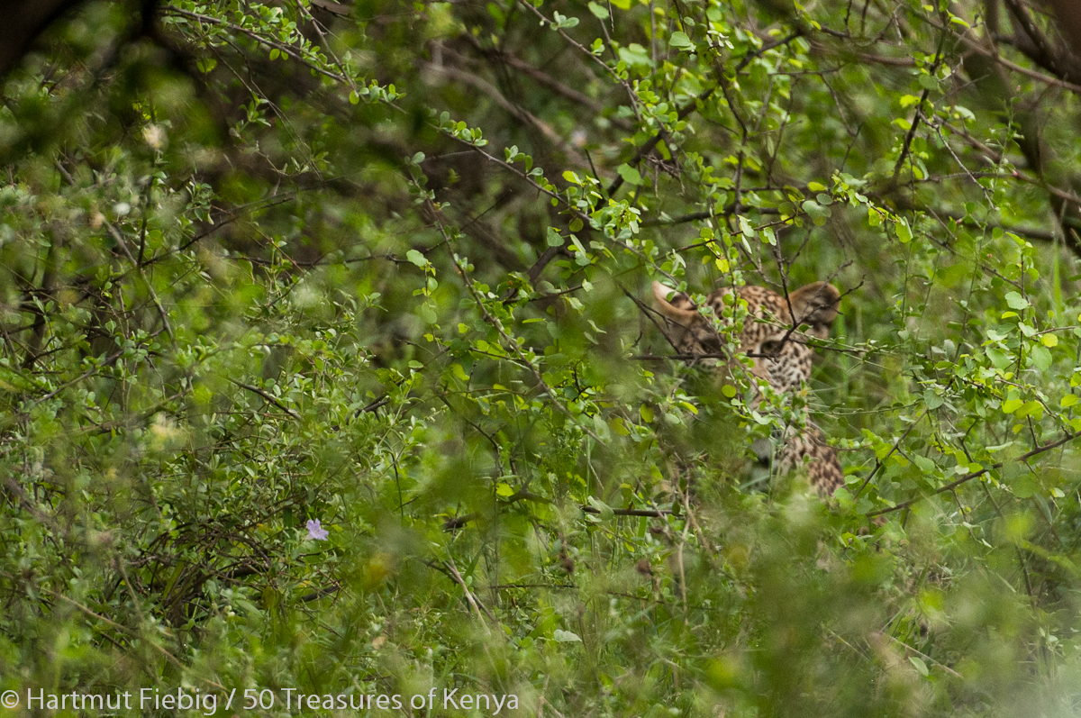
A shy young leopard peeps through the thickets by the roadside in South Turkana National Reserve.
Driving Home
Driving homewards you could pay Nasolot National Reserve and the impressive Turkwell dam in West Pokot County a visit. In Marich Pass you have the option to return via Kerio Valley and Marigat and the Cherangani Hills, both beautiful but long and strenuous drives, or through Kitale on the main road.
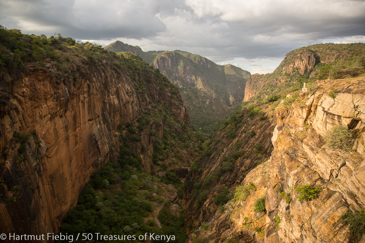
Turkwell Gorge seen from the crest of Turkwell dam.